Some Homeowners Are Discovering Their Property Lines Were Wrong for Years After a New Survey, And Gardens Built in Good Faith Are Now in Dispute
In several established American suburbs, homeowners who believed they understood their property boundaries are now finding out those assumptions were never fully accurate. New professional surveys, often triggered by renovations or sales, are revealing discrepancies that stretch back decades.
Fences, driveways, and gardens built in good faith are suddenly being reexamined under corrected measurements. What once felt like settled land ownership is now turning into quiet disputes between neighbors who never had problems before. The changes are not dramatic at first glance, but they reshape daily life in unexpected ways.
The Survey That Started as a Routine Update
The issue began for one homeowner, Daniel Mercer, when he decided to refinance his house and the bank required an updated property survey. He expected a standard confirmation of boundaries that matched the fence lines already in place. The surveyor spent several hours measuring, marking stakes, and comparing old records with modern mapping tools. Daniel watched casually, assuming it was procedural paperwork. Nothing about the process suggested anything unusual. That assumption changed when the final report arrived.
A Fence That No Longer Matched Reality
The survey report showed that Daniel’s backyard fence extended nearly three feet beyond his legal property line. At first, he assumed it must be a measurement error or outdated data. But a follow up visit by the surveyor confirmed the same result using GPS based tools. The fence had likely been installed based on older, less precise markers decades ago. Daniel stood in his yard trying to reconcile what he saw with what the document claimed. The land itself had not changed, but the legal interpretation of it had.
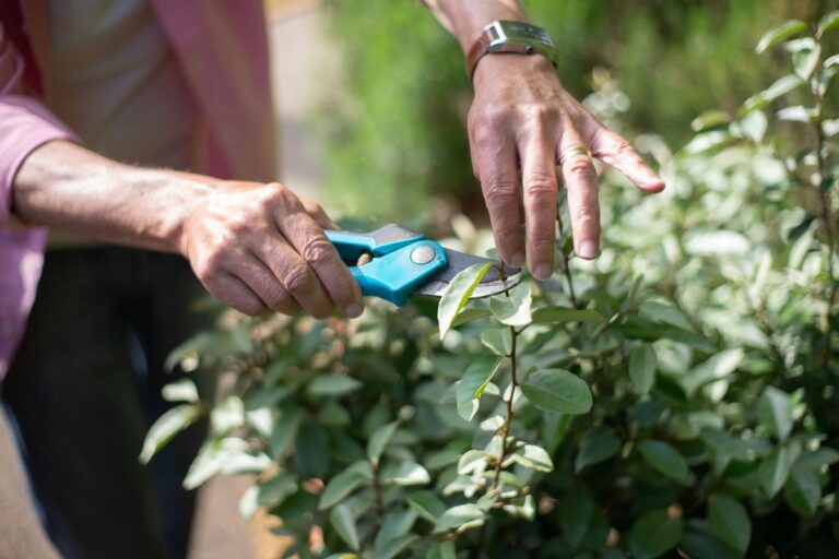
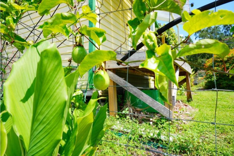
A Garden Built Over a Boundary
Behind the fence, Daniel had spent years building raised garden beds with his wife, carefully laying stone paths and planting seasonal vegetables. Neighbors often complimented the space, and no one had ever questioned its placement. Now part of that garden technically sat on land that did not belong to him. The idea felt strange because everything had been done openly and without dispute. Daniel had never hidden or crossed any visible boundary. Yet on paper, the garden now existed in a contested zone.
The Neighbor Learns About the Shift
Across the fence, his neighbor Linda Shaw received a separate notice about the updated survey findings. She had assumed the shared fence line was correct since it had been there since she moved in. When Daniel visited to explain the situation, she reacted with confusion rather than anger. Linda pointed out that she had always believed the fence marked the true boundary. The conversation ended without resolution, only uncertainty. Neither of them had done anything wrong intentionally, which made the situation harder to process.
The Survey Company Explains the Difference
When Daniel contacted the surveying company, they explained that older property records often relied on physical markers that could shift or be misplaced over time. Modern technology, including satellite mapping, now reveals discrepancies that were previously invisible. The surveyor emphasized that legal boundaries, not physical fences, determine ownership. Daniel asked what people were supposed to do when decades of use conflicted with updated data. The answer was procedural rather than emotional. It involved negotiations, not certainty.
A Second Home on the Same Street Faces the Same Issue
As word spread, another homeowner on the same street discovered a similar discrepancy involving a shared driveway. Her garage partially extended into land technically owned by a neighbor two houses down. The realization created a ripple effect, as more residents requested their own surveys. What began as an isolated case started to look like a pattern across the neighborhood. People who had lived beside each other for years began comparing notes. The sense of stability began to shift.
Tension Begins at the Fence Line
Small disagreements started emerging over everyday use of space. One neighbor trimmed shrubs slightly differently, unsure of where the boundary actually stood. Another avoided using part of their yard altogether while waiting for clarification. Conversations that used to be casual became cautious. People began measuring distances more carefully than before. The uncertainty created more discomfort than any actual dispute.
The City Gets Involved
As more reports reached the local planning office, officials acknowledged that outdated cadastral maps were contributing to confusion in older neighborhoods. They advised homeowners to rely on certified surveys rather than physical landmarks. However, they also made it clear that legal ownership changes would require formal agreements between property owners. This placed responsibility directly on neighbors to resolve matters themselves. For many, that was the most difficult part of the process. There was no single authority to settle the disagreement quickly.
A Garden Temporarily Off Limits
Daniel and Linda agreed to temporarily avoid using the disputed section of land until they could understand their options. The garden beds remained untouched, but their use became uncertain. Daniel noticed he no longer spent time in that part of the yard, even for maintenance. Linda similarly avoided the area from her side. The space that had once been shared visually and functionally now felt suspended. Nothing physical changed, but behavior did.
A Mediation Meeting Is Suggested
After weeks of uncertainty, both neighbors agreed to attend a mediation session organized by a local property consultant. The goal was not to assign blame but to explore possible resolutions, including land swaps or formal boundary adjustments. Daniel prepared documents and photos showing years of shared understanding of the space. Linda brought her own records and memories of how the fence had been presented when she moved in. The meeting was scheduled to clarify what paperwork alone could not.
Emotional Weight of Paper Boundaries
During preparation, Daniel found himself reflecting on how much of his life had been shaped by assumptions about space. The garden was not just soil and plants but years of effort and personal routine. Linda expressed similar feelings about her yard and how it had always felt complete. The idea that a line on a document could redefine both spaces felt unsettling to them both. Neither wanted conflict, but neither could ignore the new information. The emotional impact was heavier than expected.
A Compromise Begins to Take Shape
At the mediation session, both parties discussed options including formal boundary adjustment, shared maintenance agreements, and minor land exchange. After several hours, they tentatively agreed to explore a revised boundary that matched long term use rather than strict survey lines. The agreement was not final but represented progress. Both sides left with paperwork to review and legal steps to consider. The tension had not disappeared, but it had shifted into negotiation. For the first time, resolution felt possible rather than theoretical.